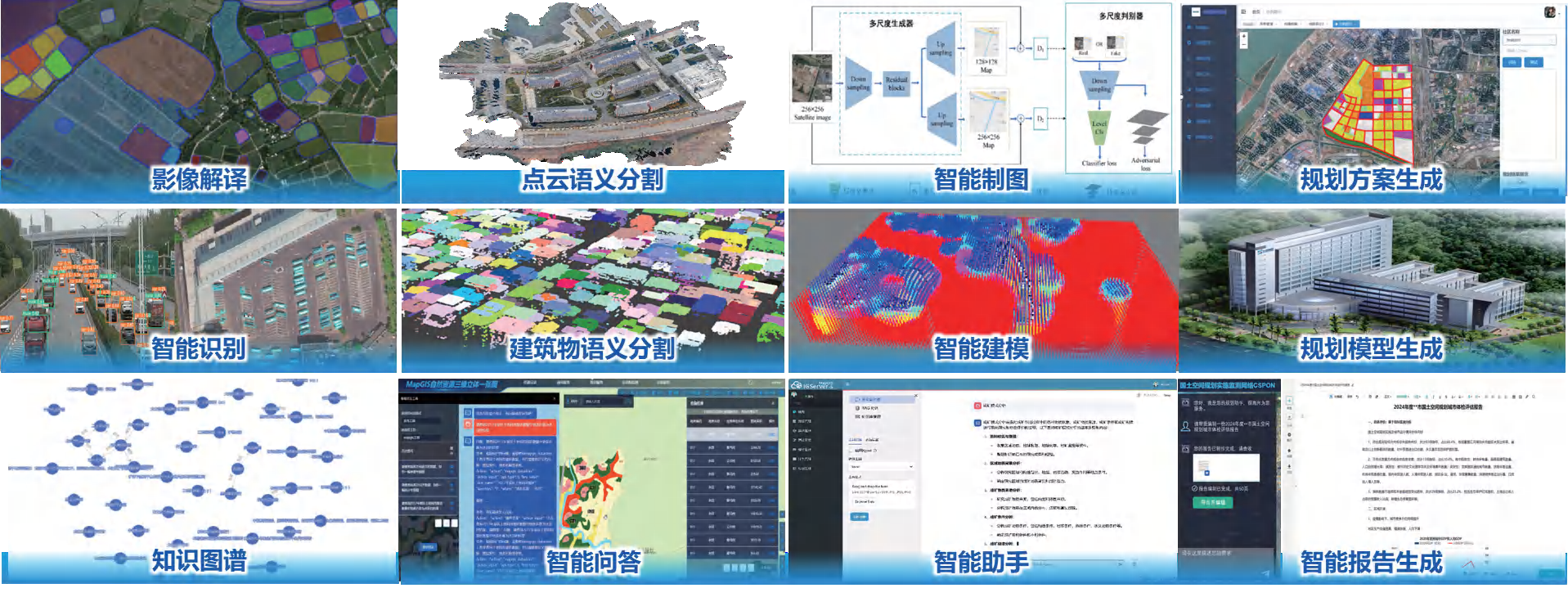
MapGIS IGServer-S is an intelligent GIS server product based on a deep learning framework, providing intelligent services such as data association and fusion, spatial analysis and prediction, clustering classification and statistics, information extraction, intelligent modeling, intelligent analysis, and intelligent interaction. It is applied in fields such as intelligent questioning, planning map generation, intelligent mining, geological knowledge graph, image recognition, target tracking, intelligent recognition, and disaster warning.
Information extraction
● Integrate into the SAM big model and adopt the target recognition+SAM segmentation mechanism to achieve segmentation and target recognition of large-scale remote sensing images
●Using enhanced Pompt prompts to achieve semantic segmentation of building objects, solving the problem of difficult differentiation of complex buildings in complex scenes
●Deep network model algorithm for point cloud local feature extraction based on dilated graph neural network and novel point network RG-GCN algorithm, suitable for semantic segmentation of outdoor and indoor scenes, respectively
●Based on the spatial processing of video source data, enhance the clarity and distinguishability of videos through video fusion and other methods, and fully utilize temporal and contextual information to quickly detect video targets.
●Added real-time inference and offline inference analysis services for small data volumes and large quantities of data, integrating services such as image segmentation and geological map extraction
●Supports the recognition of geological information such as geological text, tables, and geological column charts, and can convert the recognition content into text, tables, and other types
Data Science Computing
●Based on spatial data, provide online visualization data processing, modeling, mining, and analysis using Notebooks.
●Support web interactive sharing, collaborative construction of business analysis models, and one click publishing as a service
●Provides rich data science computing libraries such as data statistics, machine learning, and deep learning
Geographic Knowledge Graph
●Support the construction of geographic knowledge graphs to express the relationships between geographic entities in an intuitive way
●Provides directory services based on geographic knowledge graphs, supporting graph visualization methods such as compact trees and circular layouts
●Provide geographic graph query and analysis, graph association analysis, etc., to enhance the ability of dynamic perception and knowledge discovery of geographic phenomena
Intelligent modeling
●Integrating advanced deep learning methods to build a deep learning modeling framework
●Fully utilize lithological data information, mine hidden geological features, and achieve more dimensional expression of geological structural anisotropy
●Improve the generalization ability of 3D modeling models through deep learning and sample training, and better solve the modeling problems of complex geological systems
Intelligent Analysis and Interaction
●Added intelligent analysis function module for managing time-consuming AI analysis tasks, built-in image instance segmentation, semantic segmentation and other services
●Added intelligent interaction function module, using vector embedding, natural language big model and other technologies, providing knowledge base management, knowledge base Q&A,big model Q&A, natural language interpretation, tool calling, content generation and other functions for natural language big models
Large model
●Integrate various commonly used large model algorithms such as natural language large models, visual large models, and multimodal large models to empower more industry applications
●Newly added model management tool, providing process management tools for fine-tuning datasets, inference deployment, tuning, evaluation, etc., to facilitate the development of proprietary large models for the geographic industry
●Added intelligent agent application construction tools such as prompt engineering, knowledge base, plugin, rule base, etc., simplifying the process of AI agent/intelligent assistant application construction and development, improving application development efficiency and convenience

Product application scenarios
Related software
Desktop GIS
BD And Cloud Platforms
MapGIS CIM Basic Platform
Digital Twin Platform


