MapGIS 3D GeoModeler is a tool for three-dimensional geological modeling, visualization, and analysis. It integrates multiple sources of geological data such as boreholes, profiles, and physical and chemical exploration, and uses automatic and semi-automatic rapid modeling techniques to construct structural and attribute models containing complex geological features such as faults and lenses. It achieves the integrated construction of geological models throughout the entire process and provides visualization expression and analysis functions based on geological features.

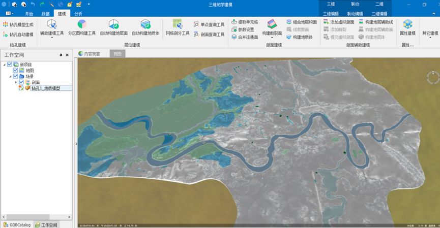
Figure 1 MapGIS 3D GeoModeler interface
ProductFeature
High precision intelligent modeling of underground space
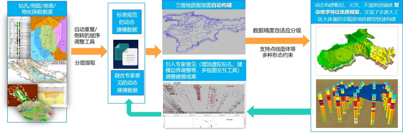
●Effectively integrating multiple sources of geological data to achieve intelligent construction of geological models that are fully integrated throughout the entire process
●Quickly construct large-scale and high-precision geological models of multi-source large-scale construction areas, solving the problems of low efficiency, large errors, and low accuracy in traditional manual modeling
●Fully integrate the modeling experience of geological experts, introduce expert opinions in the modeling process, and ensure that the modeling form is more in line with the actual geological conditions
●Add random surface modeling based on known fracture locations, orientations, and other information to simulate and analyze the distribution of fracture surfaces in geological space

Figure Intelligent modeling process for underground space
Multi precision mesh generation for complex geological models
●Support the subdivision of complex 3D geological models into cascaded grids of multiple accuracies, with the ability to dynamically switch between grid models of different accuracies
●Support the storage of grid subdivision results as geological grids, achieving distributed storage and efficient rendering of over 1 billion high-precision grids
●Support multi-attribute grid queries and dynamically switch between grid models of different accuracies based on viewpoint positions
Powerful 3D spatial analysis
●Support 3D model cutting algorithms, provide collision detection, triangle intersection, adjustment, etc., to improve the correctness and efficiency of geological body model cutting
●Provide 3D overlay analysis, clipping analysis, fusion analysis, buffer zone analysis, etc., to enhance the analysis capability of large-scale geological body models

Product trial:http://www.smaryun.com/goods.php?id=2833
Related software
Desktop GIS
BD And Cloud Platforms
MapGIS CIM Basic Platform
Digital Twin Platform


