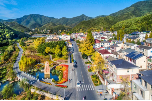
Based on the MapGIS spatiotemporal big data platform technology framework, using spatiotemporal as the foundation, we integrate rural basic geographic data, agricultural industry data, rural environmental governance data, and rural government service information to build an agricultural and rural big data center, carry out digital rural informatization construction, and promote the development of beautiful countryside.
Rural Land Transfer Trading Service Platform
Focusing on the transfer and trading of rural production factors, this platform builds a portal for information release, consultation, planning, and other supporting services for rural land contract management rights transfer and dispute arbitration. It provides comprehensive information disclosure services for the entire land transaction chain, offering convenient and efficient land transfer channels for both buyers and sellers.
Agricultural Machinery Safety Management Information Platform
Realizes dynamic management of data related to agricultural machinery purchasing, usage, transfer, leasing, annual inspection, and scrapping. Provides comprehensive information-based regulatory services covering agricultural machinery registration, license plate issuance, accident handling, and safety inspections.
Agricultural Germplasm Resources Information Service Platform
Integrates germplasm resource data of crops, trees, aquatic products, and domestic animals. Publishes agricultural germplasm resource information through network platforms, provides resource data search and query services, and promotes information sharing of germplasm resources.
Agricultural IoT Perception and Monitoring Platform
Utilizes sensor technology to access various perception information in agricultural production, such as environmental information (lighting, temperature, humidity), crop growth information (seedling conditions, pest and disease), animal life information (body temperature, weight), and agricultural machinery operation information. Assists in scientific regulation of all agricultural production stages to achieve high-yield and efficient planting and breeding industries.
Agricultural Products E-commerce Trading and Logistics Platform
Implements comprehensive information management for the entire chain of agricultural product supply, trading, and logistics, promoting the formation of a smooth agricultural product circulation system and modern rural market system that integrates urban-rural connectivity and online-offline integration.
Agricultural Product Quality Traceability and Price Supervision Platform
Establishes a comprehensive quality monitoring system and reverse traceability mechanism from origin to market, implementing electronic supervision and full-process data traceability management for key links such as raw material supply, processing, packaging, and sales of agricultural products, providing consumers with high-quality, transparent, safe, and reliable agricultural products.
Rural Tourism Information Service Platform
Develops rural tourism resources according to local conditions, relying on local characteristics such as ecological environment, natural scenery, historical culture, and folk customs to develop the tourism industry. Provides services including transportation, accommodation, dining, online tours, and online booking to promote rural tourism development.
Rural Living Environment Governance Platform
Uses GIS technology to realize comprehensive management of information on rural living environment infrastructure such as waste treatment facilities, sanitary toilets, and cultural facilities, as well as governance progress and construction achievements. Supports supervision and regulation of beautiful countryside construction and achievement display.
Digital Rural Government Service Platform
Targeted at government administrative personnel, this platform builds a rural government management information platform applied to administrative office work, smart party building, integrity supervision, and targeted poverty alleviation, improving the level of government information resource sharing and administrative efficiency.
Digital Rural One-Map System
Based on the rural and agricultural big data center, this system constructs a digital rural one-map system to achieve 3D realistic display of agricultural industry information and rural living environment, as well as monitoring and early warning of agricultural industry trends. It effectively supports comprehensive rural and agricultural management, enhancing the digital and intelligent level of rural management.
Digital Rural Visualization Dashboard
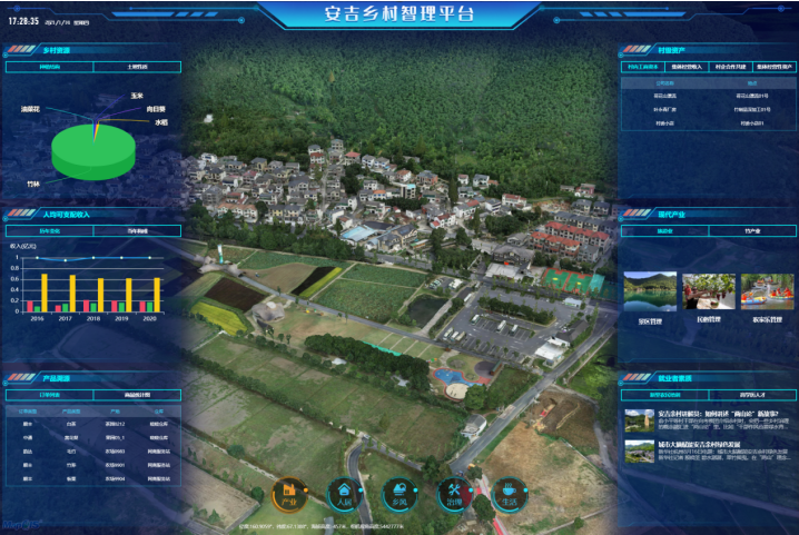
Using a modular development framework, this platform integrates agricultural industry development data, rural living environment governance data, digital rural government service information, and rural 3D realistic maps. It utilizes various visualization forms such as thematic maps, pie charts, bar charts, line charts, and dynamic charts to comprehensively present digital rural construction achievements.
Related Cases
Anji Rural Wisdom Governance Platform

Related Software
Smart City Space Time BD
Smart Policing
- Smart Emergency Command Platform
- Smart Security Combat Platform
- Smart Patrol and Prevention Platform
- Security Command and Dispatch Platform
- Smart Police Station Platform
- Integrated Border Defense Practical Platform
- Public Security Time Space Information Cloud Platform
- Mobile policing practical platform
- Integrated platform for emotional guidance and action
Smart Municipal Administration


