Realize unified dynamic management of spatial and attribute data in the thermal network, providing reliable basis and services for the planning, design, construction, operation, and evaluation of the thermal network, and improving the level of business management and efficiency of circulation in the thermal network.
Based on GIS technology, relying on database technology, data center technology, communication technology, etc., with urban basic topographic maps and thermal network data as the core, we focus on the mobility of thermal network business, integration of thermal comprehensive information, and service of thermal network data, to achieve unified and dynamic management of spatial and attribute data of thermal network, provide reliable basis and services for the planning, design, construction, operation, and evaluation of thermal network, improve the level of thermal network business management and circulation efficiency, thereby achieving intelligent operation and scientific management of urban thermal network, shaping the good image of thermal enterprises, and enhancing the economic and social benefits of thermal enterprises.
Technical Value
● Mingjia Bottom
Comprehensively integrate and consolidate asset resources, comprehensively grasp the types, quantities, and update levels of assets, and promote resource sharing among departments.
● strict control
The field operation and maintenance process can be queried, historical traces can be traced, and assessment and evaluation can be quantified, effectively improving the level of business management.
● Improve efficiency
Establish a responsive field workflow that is visible, traceable, manageable, and operates online to improve work efficiency.
● Assist in decision-making
Combining GIS to express in a visual way, providing auxiliary decision-making tools for daily business management and operation scheduling.
Pipeline GIS
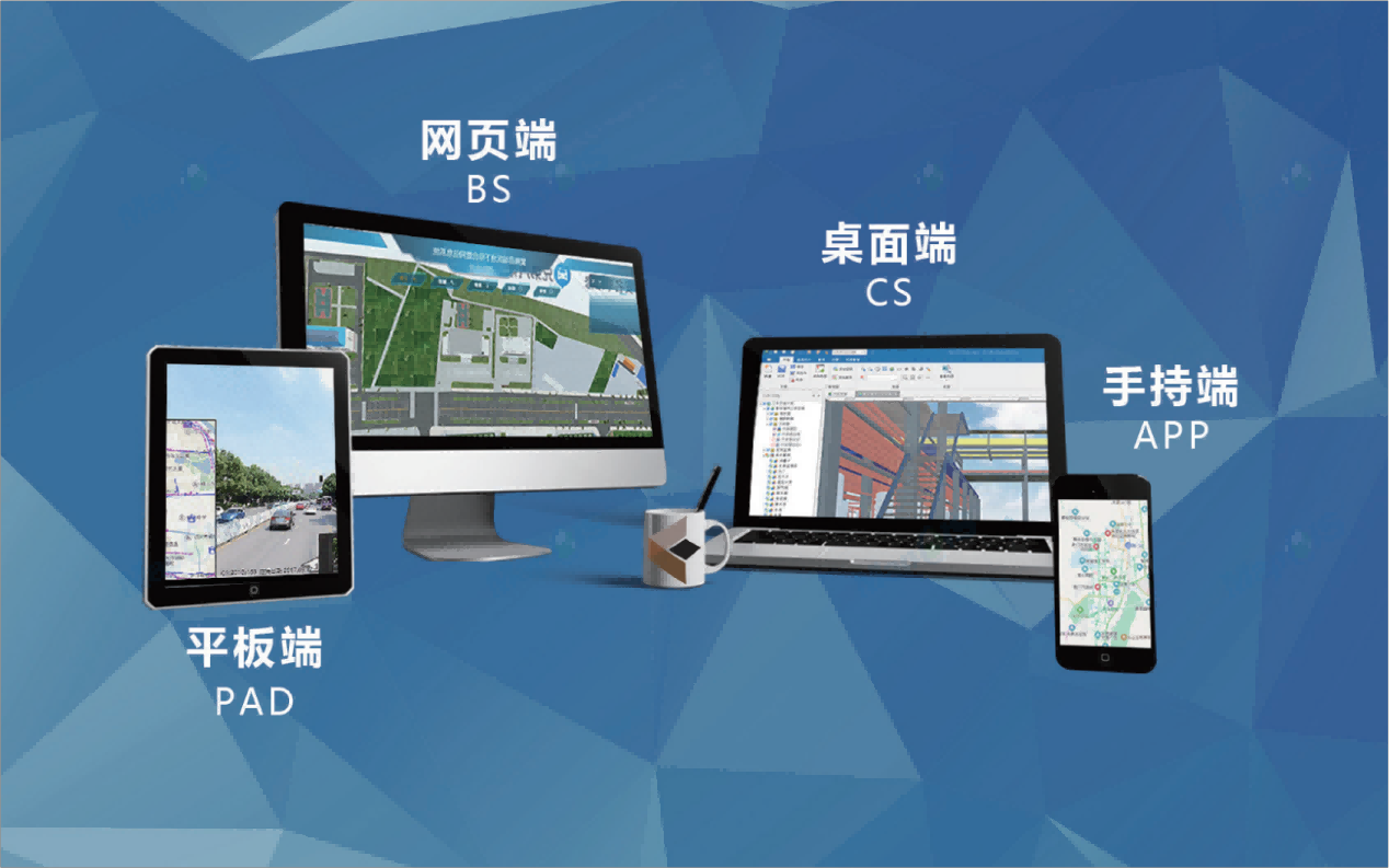
The MapGIS pipeline network GIS system provides a complete lifecycle asset management tool for thermal companies to manage, update, analyze, and apply pipeline data. It realizes the visual management and information sharing of two-dimensional and three-dimensional integrated pipeline facilities above and below ground, supports multi terminal applications, and provides effective basic data support for the intelligent application of the thermal company industry.
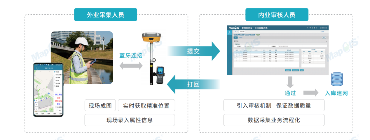
Integrated collection of internal and external operations in the pipeline network
Aiming at the detection and updating of pipeline network data, an integrated collection system for both internal and external operations of the pipeline network has been launched. Through the integration of handheld devices (such as mobile phones and tablets) and detection devices (such as RTK), field measurement on-site mapping is achieved, fundamentally changing the original pipeline network detection and storage model, improving data collection efficiency, and providing a new management solution for municipal pipeline network detection and storage.
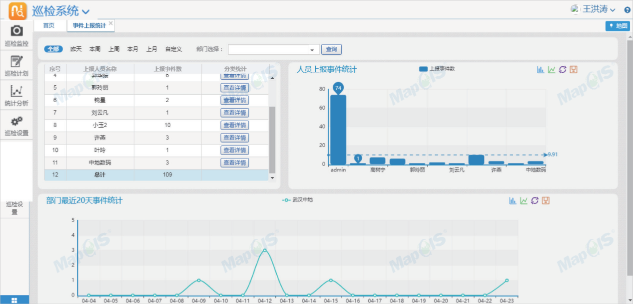
Pipeline inspection
The MapGIS pipeline inspection system will manage the entire area in a grid like manner, assigning responsibilities to individuals in each grid, establishing periodic inspection tasks, and achieving scientific, standardized, and intelligent management of daily inspection work.
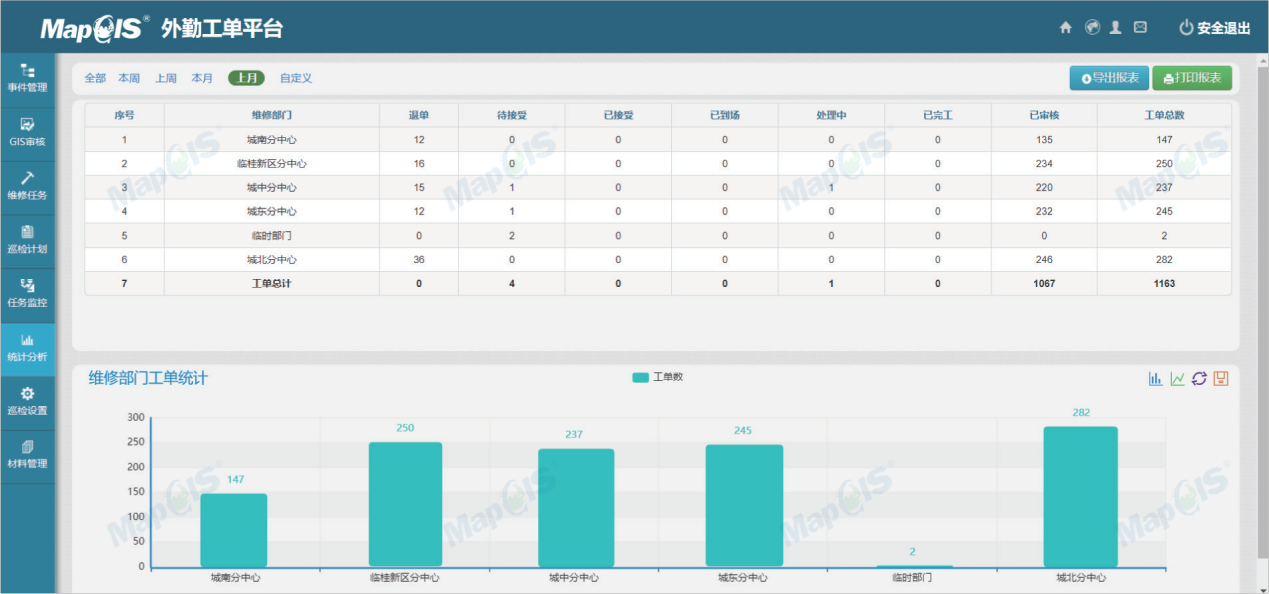
Field work order
The MapGIS field work order system supports the integration of multiple types of work orders, including but not limited to repair work orders and customer service hotline work orders. It seamlessly integrates with inspection systems and other systems to achieve unified processing of field business work orders, providing unified data support for subsequent performance evaluations.
Integrated Integrated Operations
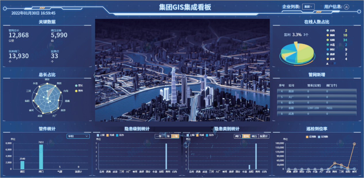
A large amount of IT investment has been made by thermal enterprises to establish numerous information systems, but with the increase of information systems, isolated information systems will result in a large amount of redundant data and repetitive work of business personnel. The integrated operation system is based on GIS to achieve the integration of multi-source heterogeneous data, deeply explore and analyze the value of data, and combine GIS to express it in a visual way, providing auxiliary decision-making tools for daily business management and operation scheduling.
Related Software
Smart City Space Time BD
Smart Policing
- Smart Emergency Command Platform
- Smart Security Combat Platform
- Smart Patrol and Prevention Platform
- Security Command and Dispatch Platform
- Smart Police Station Platform
- Integrated Border Defense Practical Platform
- Public Security Time Space Information Cloud Platform
- Mobile policing practical platform
- Integrated platform for emotional guidance and action
Smart Municipal Administration


