


More Applications
Provide high-quality solutions and services for more industry users and partners
The multi-source remote sensing data management solution adopts a service-oriented design concept and a multi-layer architecture, realizing data organization for spatial entities and their relationships, efficient storage and indexing of massive spatial data, and large-scale multi-dimensional dynamic spatial information database.
The multi-source remote sensing data management solution adopts service-oriented design concepts and multi-layer architecture, realizing data organization oriented to spatial entities and their relationships, efficient storage and indexing of massive spatial data, large-scale multi-dimensional dynamic spatial information databases, with PB-level spatial data management capabilities. It supports distributed computing of spatial data under local and wide area network environments, supports distributed spatial information distribution and sharing, and networked spatial information services, being able to support massive, distributed national spatial infrastructure construction.
Main Features
●Process-based construction method for rapid implementation of image and auxiliary data database entry management.
●Metadata index management to achieve consistency of multi-source heterogeneous remote sensing data and auxiliary data.
●Good visualization effects, efficient query and retrieval, and convenient output.
●Integration of vector thematic analysis, raster thematic analysis, and 3D thematic analysis.
●Convenient map output, providing mapping templates of multiple scales to achieve rapid mapping of images and vector data.
Main Functions
●Data entry: Through entry workflow, rapid implementation of image, vector, and metadata entry.
●Metadata indexing: Rapidly establish indexes based on managed images and auxiliary data, and rapidly achieve expansion of managed data.
●Image data query: Provide metadata indexing, spatial information, and custom query methods for rapid retrieval and positioning.
●3D terrain display: Overlay topographic maps and remote sensing images to generate 3D real scenes, which can intuitively display detailed information from any angle and direction.
●3D thematic analysis: Provide 3D thematic analysis such as slope, aspect, solar radiation, cut-and-fill, and flood inundation analysis.
●Remote sensing thematic products: Based on managed data, provide thematic products such as change detection, image classification, and land surface temperature.
●Information publishing: Provide information publishing of multi-source remote sensing data, facilitating users to access data through IE browser to achieve query, statistics and other functions.
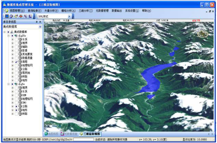
3D Rendering View

Map View
Typical Cases
●National Basic Surveying and Mapping Results Database Integration Management System
●Central South Repository Geological Data Management System
●National Geological Database Integrated Management System
●……
Related Software
Smart City
- Smart City Spatiotemporal Big Data Platform
- MapGIS Smart Thermal Solution
- Smart Emergency Command Platform
- MapGIS Field Work Order Solution
- Enterprise One Picture Solution
- Smart Security Combat Platform
- MapGIS Pipeline GIS Solution
- Smart Chemical Industrial Park Solution
- Smart Patrol and Prevention Platform
- MapGIS Integrated Management System Solution for Underground Municipal Facilitie
Natural Resources
- National Land Space Basic Information Platform: Smart Hub
- National Spatial Planning Implementation Monitoring Network (CSPON)
- Real estate convenience service system
- Realistic 3D Solution
- Natural Resource Asset Management Solution
- One code land management solution
- Ocean monitoring solutions
- Intelligent Disaster Management Solution
- Integrated solution for natural resources e-government
- Land survey solution
Smart Geology
- MapGIS Digital Twin Watershed Solution
- MapGIS Groundwater Informatization Solution
- MapGIS Iterative Geological Modeling Tool
- Geological Informationization Solution
- MapGIS Geological Data Management and Display System
- MapGIS Field Data Collection System
- MapGIS Smart Environmental Protection Solution
- Integrated solution for urban geology above ground and underground
- Geological big data cloud platform
- MapGIS Mining Management and Modeling System
More Applications
- Series solutions for the communication industry
- MapGIS CIM Underground Space Platform
- Smart wind power solution
- Solution for Radio and Television Resource Management
- Transportation Meteorological Support Service Solution
- High performance processing solution for remote sensing images
- Multi source remote sensing data management solution
- Solution for Multi source Meteorological Information Integration Application and Service Platform
- Solution for Visualization Platform of Meteorological 3D Storm Body Echo Data
- Solution for Weather Radar Construction Business Platform


