


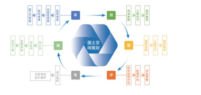
NRSDMS
Based on the MapGIS platform and supported by the national spatial basic information platform, six subsystems are constructed, including the application of "one map" for national spatial planning, national spatial analysis and evaluation, review and management of national spatial planning results, supervision of national spatial planning implementation, indicator model management, and social public services. These subsystems support scientific planning, automatic approval, dynamic monitoring, intelligent evaluation, and intelligent deduction.
Service Direction:
Product Highlights:

Construction Content:
Application of "One Map" for Territorial Spatial Planning
Aggregating four categories of data including current situation, planning, management, and socio-economic information, utilizing full-space above-ground, surface, and underground two- and three-dimensional integrated technology to comprehensively display the overall territorial space situation, achieving "one-map control" of territorial space dynamics.

Territorial Spatial Analysis and Evaluation
Encapsulating professional and complex algorithm models into callable tools, enabling visual configuration of evaluation models, and flexibly building evaluation algorithms according to regional characteristics to significantly improve the scientific nature of evaluation and the efficiency of planning and design.

Review and Management of Territorial Spatial Planning Results
Based on the rule configuration library, the system establishes a five-level and three-category planning result quality inspection + review scheme, supporting consistency checks for graphics-text, indicators, space, and graphic-data. It adopts a combined review method of "machine quality inspection" + "manual review" to strictly control the quality for subsequent "one map" construction of territorial spatial planning.

Monitoring, Evaluation and Early Warning of Territorial Spatial Planning
Supporting the construction of monitoring and early warning models for three zones and three lines and key areas, urban health assessment models, risk identification assessment and special assessment models, achieving intelligent dynamic monitoring, timely early warning, and regular assessment of territorial spatial planning implementation, supporting responsible departments in supervising the implementation of main responsibilities, and assisting managers in decision-making.

Monitoring and Early Warning of Resource and Environmental Carrying Capacity
Integrating and aggregating monitoring data on resource and environmental carrying capacity from relevant departments, using intelligent analysis to comprehensively monitor, dynamically evaluate land resources, water resources, ecology, environment, and disaster factors, and grasping the implementation of planning through various forms of data display.

Territorial Spatial Planning Indicator Model Management
Establishing a comprehensive indicator system and supporting models covering territorial spatial analysis and evaluation, planning implementation, result review, monitoring, evaluation, and early warning business directions, while supporting visual configuration and flexible expansion of indicators/models, fully supporting business transformation, constructing indicator transmission mechanisms, and building full-business application models.

Public Service
Facing the public and using various open channels, providing declassified and desensitized territorial spatial planning services, building open display, opinion solicitation, and public supervision applications to enhance public participation in territorial spatial planning work.

Application Cases:
Shenzhen Smart Planning Information Platform Project
The Shenzhen Smart Planning Information Platform takes the domestic independent platform MapGIS as its core, building a smart planning information platform framework, forming a "one lake, multiple pools" data center, creating a planning professional toolset, constructing an indicator model library, and developing typical domain applications. By precipitating digital assets, it empowers smart planning, achieving data servitization, platform servitization, online environment, toolized operation and maintenance, and collaborative standards, realizing business service transformation and informatization development.

Related Software
NRSMA
NRSDMS
- Natural Resource Asset Management Solution
- Intelligent Disaster Management Solution
- Solution for Urban Physical Examination Evaluation Information
- Implementation Supervision Information Solution for the "One Map" of National Spatial Planning
- Solution for Land Space Use Control and Supervision
- Green Mining Intelligent Solution


