Welcoming the "flood" intelligent prevention, MapGIS intelligent drainage builds a new ecological system for urban flood prevention
Recently, many areas have entered the plum rain season, and numerous cities have suffered from continuous heavy rainfall, causing damage to bridges and culverts, flooding in multiple residential areas, and continuously escalating pressure on urban waterlogging prevention and control.
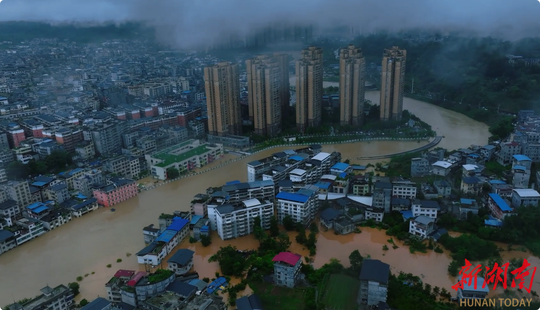
Image source: Xin Hunan Client
Under heavy rains, persistent problems in drainage networks have become evident: overloaded aging pipelines, lagging facility operation and maintenance efficiency, and slow emergency response指挥, leading to repeated occurrences of "cities seeing the sea." At the root of these issues, unclear understanding of drainage systems, lack of monitoring methods, and extensive management approaches have become bottlenecks constraining safe flood control in cities.
Facing this pressing livelihood issue, Zondy Digital leverages over 20 years of experience in pipeline informatization construction to launch the MapGIS Smart Drainage Solution. This solution deeply integrates GIS technology with IoT and big data capabilities to build an integrated "stormwater-sewage" pipeline management platform, covering core scenarios such as full lifecycle management of drainage assets, intelligent scheduling of field operations, and flood emergency command decision-making. Through digital technology empowerment, it achieves closed-loop management from pre-flood预案 simulation, mid-flood dynamic early warning, to post-flood review and optimization, installing a "smart brain" for urban drainage and flood control systems, making risk prevention and control more precise and efficient.
I. Fully Indigenous GIS Foundation, Building a Secure and Controllable Digital Base
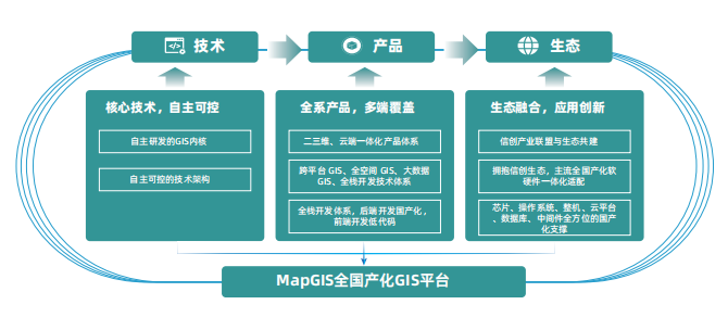
The solution is built on the fully independent indigenous GIS platform MapGIS, which deeply integrates cloud computing, IoT, and big data technologies, fully adapting to domestic chips, operating systems, and databases, breaking through "neck-pinching" technological bottlenecks. Through cross-platform unified kernel, it achieves distributed storage and second-level computing of ultra-large-scale pipeline data, supports integrated 2D/3D display and full-space analysis, seamlessly fusing underground pipelines, pumping stations, and surface buildings to provide accurate spatial benchmarks for drainage operations. Its heterogeneous GIS results migration solution supports smooth transitions at data, service, and application layers, helping users quickly complete indigenous replacement.
II. Intelligent Perception and IoT Collaboration, Weaving a Dense Urban Drainage Monitoring Network
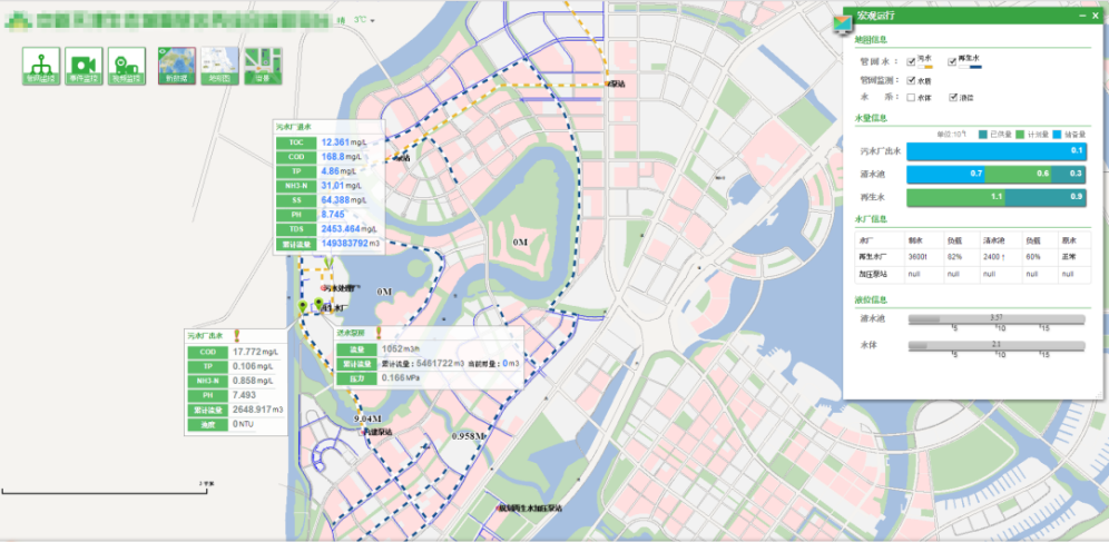
Based on GIS, it achieves watershed-based and grid-based production and operation management of drainage systems. Meanwhile, it monitors water quality, flow velocity, and liquid levels at plants, stations, networks, and rivers (lakes) through maps, unifying the aggregation of water system and watershed monitoring information, setting threshold ranges for targeted multi-level early warning. It comprehensively displays water volume and quality monitoring conditions across the entire area's water domain, achieving real-time dynamic monitoring, early warning and forecasting, and decision analysis for all drainage operations, forming a unified drainage operation map.
III. Full Process Digital Management, Activating the Lifecycle Value of Drainage Facilities
From pipeline census to facility maintenance, it provides a full-chain digital toolkit. The pipeline GIS system offers integrated 2D/3D data management capabilities, supporting the fusion of BIM models and oblique photography data, with built-in 3D automatic pipeline modeling tools that can batch-generate underground pipeline models, greatly improving modeling efficiency; the integrated indoor-outdoor data collection system connects with mainstream RTK equipment, enabling on-site mapping of field survey data and shortening the cycle for indoor database construction.
At the operation and maintenance level, gate and pumping station management modules establish equipment electronic archives and maintenance models, while the wastewater treatment plant management system achieves dynamic optimization of energy consumption and treatment efficiency, promoting the transformation of facility management from reactive repair to preventive maintenance.
IV. Business Closure and Emergency Response, Reshaping Urban Flood Control Management Systems
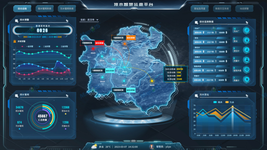
By constructing a flood emergency spatiotemporal big data center, deeply integrating GIS full-element data foundation, IoT monitoring, and meteorological rainfall information, it establishes intelligent drainage analysis models and a six-level early warning system, achieving flood risk prediction and intelligent matching of emergency plans. Relying on a platform-based workflow engine, it connects the full closed-loop management process of emergency resource scheduling, repair order dispatching, and处置 progress tracking. Combined with hydraulic model dynamic simulation of积水 diffusion paths, it coordinates the allocation of personnel, materials, vehicles, and other emergency response resources, ensuring rapid and scientific decision-making from early warning response to on-site处置, comprehensively enhancing urban flood control and drainage emergency response capabilities.
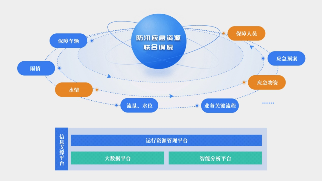
V. Digital Twins and Intelligent Decision-Making, Empowering Urban Resilience Upgrades
Deeply integrating hydraulic models, AI, and digital twin technology, it builds a multi-dimensional flood control system: through the SWMM precipitation-runoff model combined with pipeline data and meteorological information, it achieves real-time prediction of waterlogging risks and simulation of调度 plans; based on AI algorithms that automatically analyze pipeline inspection videos, it improves defect identification efficiency and pipeline health assessment capabilities; relying on the CIM platform to build a drainage digital twin system, it dynamically displays facility status and hidden dangers by fusing 2D/3D GIS and IoT data, forming a virtual-real interactive intelligent decision-making closure loop, providing full-process technical support for waterlogging prevention and control.
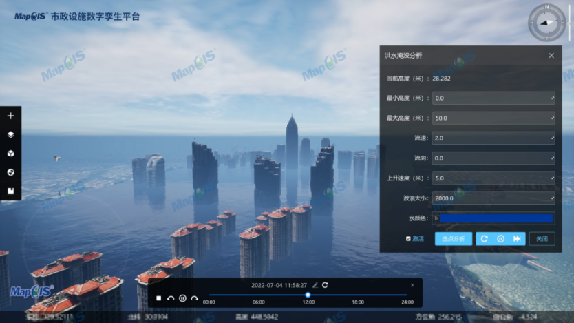
Facing the normalized challenge of extreme weather, the MapGIS Smart Drainage Solution重塑s urban drainage management systems with full-chain digital capabilities of "perception-analysis-decision-execution." Currently, Zondy Digital has initiated the "Flood Season Escort Action" to provide technical support such as pipeline health assessment and积水 simulation演练 for urban management departments, empowering urban waterlogging governance with technological strength.


