The 2025 China International Fair for Trade in Services (CIFTIS) has come to a successful conclusion, with Zhongdi Digital participating in the project and making its debut
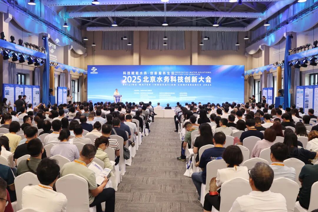
From September 10th to 14th, the 2025 China International Fair for Trade in Services (CIFTIS), jointly hosted by the Ministry of Commerce and the Beijing Municipal People's Government, successfully concluded at Shougang Park in Beijing. The China International Fair for Trade in Services has carefully crafted themed exhibitions and 9 special exhibitions, attracting nearly 2000 companies to participate offline and nearly 5600 companies to participate online. As of 16:00 on September 14th, the total number of visitors has exceeded 280000. In order to comprehensively summarize the technological innovation achievements of Beijing's water industry in recent years, showcase the technological breakthroughs and demonstration applications of Beijing's water industry in the field of science and technology, this year's Service Trade Fair has launched the 2025 Beijing Water Science and Technology Innovation Conference, and set up a water science and technology innovation exhibition area.

Photo source: official account Shuirun Jinghua
The exhibition area is divided into four sections: waterfront space, smart water management, healthy water industry, and water conservancy and hydropower engineering construction. It focuses on showcasing new water related technologies, methods, and equipment. Leading and benchmark enterprises in the domestic water industry participate in the exhibition, showcasing the progress and highlights of the integration of scientific and technological innovation work and water services from different perspectives.

Photo source: official account Shuirun Jinghua
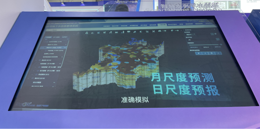
Among them, the underground water digital twin and 3D simulation platform developed by Zhongdi Digital was unveiled at the exhibition. In terms of top-level design, the platform is divided into two sub modules: data management and publishing subsystem and underground water map display subsystem, including 8 functional zones: 3D geology, numerical model, underground water dual control, water extraction demonstration, strategic reserve, ecological water replenishment, overexploitation area, and risk warning. Different functional modules carry specific missions and tasks in the platform, weaving together an efficient and intelligent management network. For example, in terms of three-dimensional geology, the project integrates the construction of a three-dimensional hydrogeological structure model of hydrogeological units in the city plain area and planned river sections, develops hydrogeological three-dimensional visualization functions, digitizes the groundwater storage space, transparently displays hydrogeological conditions, realizes model management, model display, rotation, roaming, cutting, virtual drilling and other functions, allowing management and business personnel to see the hydrogeological internal structure and properties of the groundwater storage space. In the base model of a cooperative plain area in a certain city, a three-dimensional hydrogeological structure model at the scale of hydrogeological units in the planned river section was built as a pilot project; Based on the existing perception network construction and utilizing modern computer technology, a multi-scale three-dimensional hydrogeological structure model and numerical model are integrated to construct a digital twin and three-dimensional simulation platform for groundwater, thereby enhancing the digitalization and intelligence level of groundwater management work.

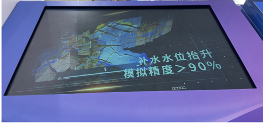
On the solid foundation of technological breakthroughs and platform construction, the project is steadily moving towards a new stage of application of achievements, striving to transform the digital and intelligent advantages of groundwater management into practical efficiency, and contribute to the high-quality development of urban water resources. On the one hand, the project achievements can fully play a role in improving the level of water public services. The official website of the Water Affairs Bureau can regularly release the monitoring information and analysis results of groundwater in the city, and timely release the dynamic characteristics of groundwater through text, charts, etc., providing important support for the calculation of water resources carrying capacity and groundwater reserves. On the other hand, it can also be applied to ecological water replenishment scheduling work to ensure the safe and orderly implementation of ecological water replenishment. The platform combines automatic monitoring and simulation prediction to achieve real-time monitoring and scientific prediction of groundwater level in the ecological water replenishment area. It controls the dynamic changes of groundwater level, groundwater flow field and replenishment effect in the replenishment area, playing a fundamental role in ensuring the safe and orderly implementation of ecological water replenishment.

In the future, relying on over 30 years of platform capabilities, Zhongdi Digital will continue to promote the construction of groundwater dynamic models and advance and deepen the digital management of groundwater.


